So, you’re going fishing on the world famous Yellowstone River in Montana. Maybe it’s later this week. Maybe it’s not until late July. Whenever it is, there is some research you should conduct before your trip. In today’s modern world, most of the time, there’s no reason to show up at your chosen fishery and be completely surprised by what you find.
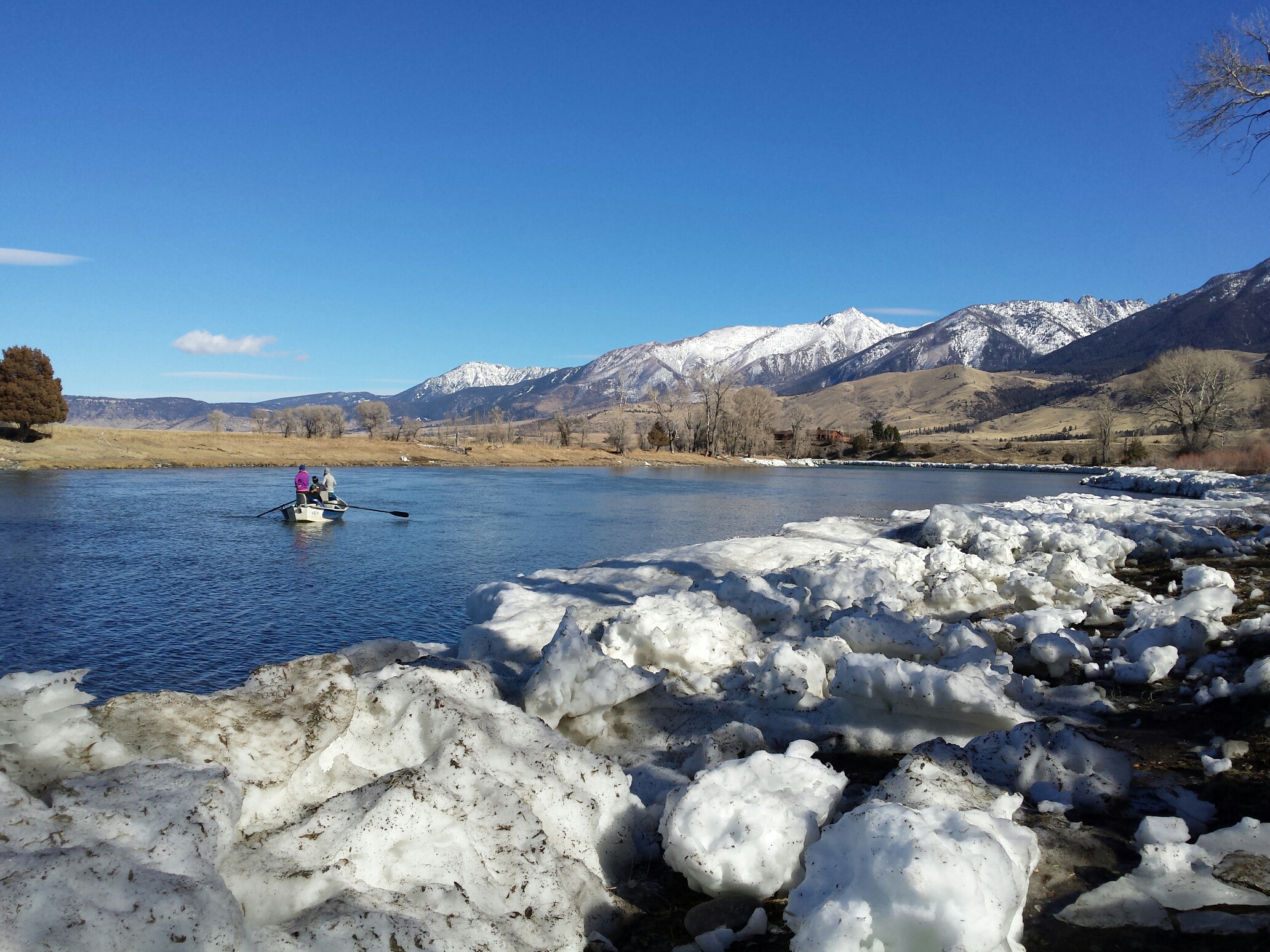
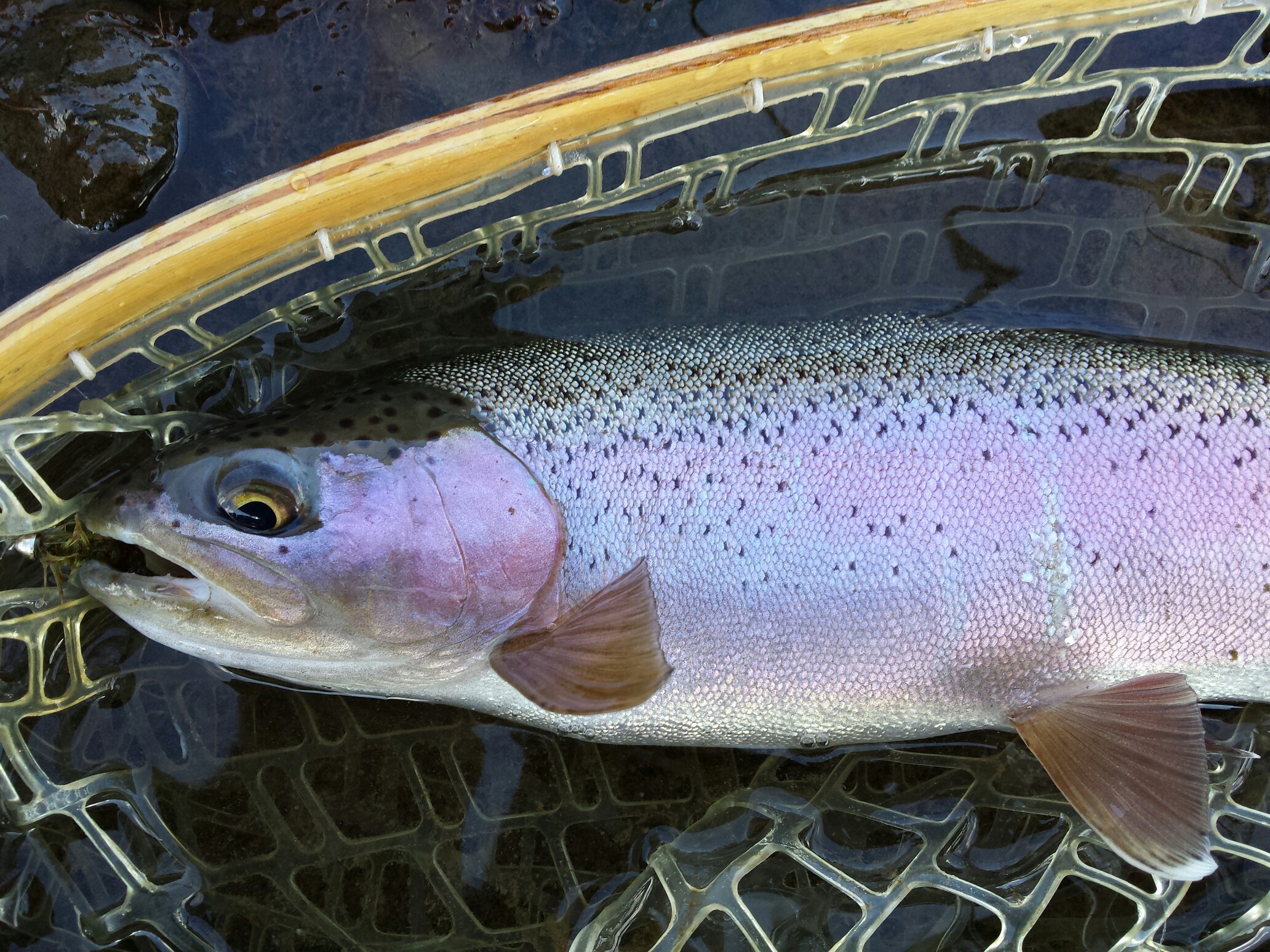
You don’t want to show up for a fishing trip expecting to find this
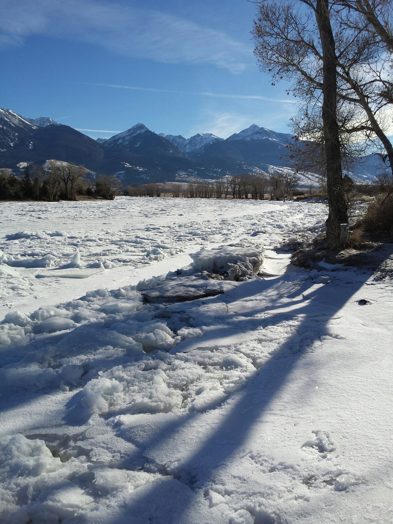
When this is what you get
Snow Forecast:
Here in Montana, our stream and river flows are often dependent upon run-off from snowfall high in the mountains. But how do you know when run-off will occur; and will it be heavy or short-lived. Are we on pace for a great water year that will extend excellent fishing throughout the summer? Or should you think about coming early, or maybe late, in the year to avoid potentially warm summer weather because of low flows?
With this Snow Precipitation Update web page, you can see how our snow pack is progressing and use that data to help you plan a long range trip. If you’re planning to fish the Yellowstone River around Livingston, scroll down to the 15th section, titled Upper Yellowstone River Basin, and look at the readings for Two Ocean Plateau. Two Ocean Plateau is located in Yellowstone National Park, but the snow that falls in this area is the primary water source for the Upper Yellowstone River from Gardiner to Livingston.
There are 7 numbers aligned in this category. The first is elevation. Forget about that one, it’s unimportant for our purposes. The next two numbers are the current and median snow to water equivalency, illustrating the snow’s moisture content. The third number shows the current percentage of water in the snow. These 3 numbers are important. All snow isn’t equal. Snow with a higher moisture content will give the river more water in the spring than a dry, powdery snow.
The final 3 numbers show the current and average amount of total precipitation for the year and the percentage of average. You can use these numbers to see if we are at, above, or below average for yearly precipitation. If the chart looks close to normal, you can reasonably expect (with near average springtime air temps) normal run-off in June. If we are well above average in snow amounts, run-off may continue into early to mid July. If we are significantly below average, then run-off may end early, sometime in Mid to late June.
Today, January 19, 2016, the site shows us with 14.2 inches of snow and a median of 15.6, bringing us to 91% of the moisture content that we normally have on the ground this time of year. Current precipitation is at 14.6 inches with average being 15.6, leaving us at 94% of the precipitation we normally receive by this point in the season. So, snow-pack is near normal, but we could be doing a little better. Lucky for us (or unlucky depending upon who you ask), we still have a lot of snowy days to come.
USGS Water Levels

If you’re planning a more current trip, say a couple days from now rather than a couple months, then the USGS web site is another great tool. You can view the United State Geological Survey’s (USGS) website for Montana watersheds in real-time to show current water levels. Scroll down to the third section to find the flows for the Yellowstone River Basin. You’ll see that there are several entries for the Yellowstone. The two I use for fishing the river in Paradise Valley, or around Livingston, are the Yellowstone River at Corwin Springs and the Yellowstone River near Livingston gauges. Corwin Springs is a small town along Route 89 approximately half way between Gardiner, MT and the Yankee Jim Canyon. The gauge near Livingston is sort of self explanatory.
The gauges show you four important things. First is the Long Term Median Flow. Median is similar to average, but it doesn’t include outlying highs or lows in the data, so it actual gives a more clear picture of “average.” So the first number is showing you the river’s historical flow for this particular day of the year. The second number is the Current Discharge. This shows you the current river level. Both of these numbers are given in CFS or cubic feet per second. If you just had these two numbers you can get a pretty good idea of how the river is fishing–is it low, high, or average. The final two numbers are Gauge Height (listed in feet) and for some of the gauges, Temperature, though temperature is not listed in all the gauges. The temperature gauge is especially important in the summer as the river warms so conscientious anglers can know when to leave the fish alone or when Montana Fish and Wildlife may temporarily close a river due to water temps.
The USGS site is perhaps your most important tool for planning your trip. It tells you the exact river flow right now, how that compares to it’s average, how high the river is flowing and at what temperature. But in spite of all this great data, it doesn’t give you the full picture either. It doesn’t tell you the predicted weather. So if thunderstorms are going to hit the river and hour after you leave then you won’t see that result in the USGS gauges because it hasn’t happened yet. You need to check the weather.
NOAA and the National Weather Service
![]()
Weather in Montana’s isolated valleys, plains, and mountainous regions is extremely variable. Livingston in particular seems to generate its own weather. I live about 15 miles south of Livingston in Paradise valley, yet it is common for the wind to be howling in Livingston and barely blowing at my house. It also seems to be usually slightly warmer in town than it is in the Valley. I check the NOAA weather web page every day before I fish, even in the winter; If the forecasted temperature is above freezing (meaning my guides won’t constantly freeze), I’m likely to go fishing. I usually look more closely at the Pray, MT weather than the Livingston weather because Pray is in Paradise Valley where I’m most often fishing. The Livingston weather is likely to contain a windy forecast (particularly in Winter and Spring) that may not be accurate for what is taking place along the river in the Valley or above the Yankee Jim Canyon.
Fishing Reports
After checking river and weather conditions, your next move should be to actually find out how the river has been fishing. We, here at Sweetwater, fish every chance we get. When we’re not fishing, we’re talking to our guides who are on the water every day. So we usually have a pretty good idea of what’s happening out there. We don’t update our fishing reports as much in the winter as we do during the spring, summer, and fall because there isn’t a lot of fishing diversity in the winter. In fact, I can give you a decent winter report right now for the entire season: If there is flowing water (not entirely iced-over) you should try fishing nymphs and streamers. If you nymph, you’ll most likely catch a whitefish (or several) and hopefully some trout. If it’s a warmer winter day, there’s a chance you could find some fish rising to midges. If you catch them, you’ll most likely catch a whitefish (or several) and hopefully some trout. If you like fishing streamers, begin by dead drifting them, then slowly try twitching or crawling them along the bottom. If you fish some smaller streamers (and you should in the winter) you’ll most likely catch a whitefish (or several) and hopefully some trout. Ok, maybe that’s not an entirely fair winter fishing report, but it’s close. Click here for the real Sweetwater Fishing Report
Web Cams
So you’ve checked the USGS gauges. You’ve checked the weather. You went online and checked Sweetwater’s fishing reports. Your ready for your trip. But if you are still hesitant, you have one more option: You can check-out the two web cameras on the river. The first webcam, the Electric Peak Webcam is located above the Yankee Jim Canyon, which gives some much needed insight into river sections that we don’t pass on our way to the shop in the morning. But the images from this camera are oftentimes difficult to see, particularly early in the morning. The second camera, the Lone Tree Ranch Camera, is excellent. You can even use this web cam, which is further down the Valley, near Pine Creek, on the morning of your fishing trip to check the river’s clarity.
Sweetwater’s Mobile App
Want to have most of the above information right at your fingertips? Download Sweetwater Fly Shop’s free mobile app! It’s available for the iPhone or iPad and for Android. In addition to links to the USGS flow gauges, local weather, our fishing reports, and other handy information, it has a bunch of other useful features, including GPS coordinates for the public fishing accesses on the Yellowstone River, the ability to send us your fish photos, and even help in finding your way back to your car. It’ll take your Yellowstone River fishing trip planning to another level!
Lest we forget, you can also download a pdf file of “Fly Fishing in Paradise,” the informative “booklet” that we wrote up about fly fishing and other activities in the area.
Well, there you have it. You’re as prepared as you can be for what to expect during your trip to the amazing Yellowstone River. But if you need anything else, let us know what we can do to help.
Then the fish-catching part is up to you. Good luck!
0

Leave a Reply
You must be logged in to post a comment.